 The Independent Uganda: You get the Truth we Pay the Price


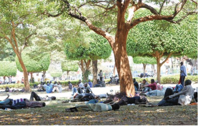
What Ugandans, especially in Kampala, are experiencing as rising temperatures could be due to a phenomenon scientists call the “urban heat island”—the urban area or metropolitan area that is significantly warmer than its surrounding rural areas due to human activities. Kampala’s so many high-rise buildings, people, cars and factories are all contributing to greenhouse gases which accumulate in the atmosphere and create a blanket, Mujuni says.
If further accumulation of gases occurs, it is like an individual having a blanket over their body which makes them warm and then an extra blanket is added. High-rise buildings and cemented surfaces normally trap energy from the sun and shed it at night.
Mujuni says minimum or night temperatures are becoming warmer in comparison to those taken in the early 1990s according to temperature analysis done on data from 1981-2010.
Monitoring temperatures is important to scientists because, according to them, regardless of changes in rainfall, it is the change in temperatures which are likely to have the greatest implications for water resources, food security, natural resource management, human health, settlements, and infrastructure.
Therefore, experts were not surprised that a review by the Uganda National Meteorological Authority published on Jan.6 of the rainfall performance of the September— December, 2016 seasonal period noted low rainfall across the country.
In Uganda, the month of December is usually associated with the end of the September-December seasonal rainfall and indeed analysis for the month shows that most parts of the country experienced general reduction in rainfall compared with the long term mean rainfall.
December to February is generally dry because of the Inter-tropical convergence zone (ITCZ) having moved south by that time.
The ITCZ describes the area impacted when moving low and high pressure air masses meet and cause wet conditions wherever they converge and dry conditions elsewhere. The convergence occurs at what scientists call the `thermal equator’ to describe the area getting the most overhead heat from the sun. For Uganda, and most of East Africa, that happens in March and September every year.
So September to November is the other rainy season. These rains are also associated with the ITCZ. But these are the short rains season. Because of these systems, most of Uganda has a mean annual rainfall of approximately 1200mm.
The months in between; from December to February and from June to August, are generally dry seasons. That completes the four broad rainfall seasonal patterns.
However, apart from the ITCZ movement, local weather is also influenced by other air masses such as sub-tropical cyclones, monsoonal winds, large water masses, human activities, and topography, including mountains.
For example, during the 44th Climate Outlook Forum for the Greater Horn of Africa held in Kampala last August, the national, regional and international climate scientists noted that the major physical conditions that were likely to influence the evolution of weather conditions over Uganda and the rest of the region for the forecast period of September—December 2016 would be mostly La Nina conditions over the equatorial eastern Pacific Ocean.
La Nina is a weather phenomenon associated with cooler than average sea surface temperatures in the central and eastern tropical Pacific Ocean. It leads to wetter-than-normal conditions in Southern Africa from December to February, and drier-than-normal conditions over equatorial East Africa over the same period.
At a more localised level, heavy precipitation and the land breeze effect around Lake Victoria can cause some rain to fall outside of the ITCZ movement.
The directorate of meteorology said in a statement that the seasonal onset was late and the distribution, both in time and space, was also poor throughout the country.
Only parts of southern Uganda, especially the areas surrounding Lake Victoria experienced some isolated single day storms.

Bushenyi District recorded the highest monthly total rainfall of 96.6mm followed by Kampala with 75mm, and Mbarara with 69.9mm.
In terms of percentages of observed rainfall compared with their respective long term mean rainfall, Gulu registered the highest with 110% followed by Mbarara (98%), and Bushenyi (85%). The lowest of 0% was registered at Lira weather station in northern Uganda.
The rainfall outlook for February 2017 indicates a continuation of sunny and dry conditions in most parts of the country. Once again only a few areas in south-western Uganda and the Lake Victoria basin will experience light to moderate rainfall amounts this month.