 The Independent Uganda: You get the Truth we Pay the Price


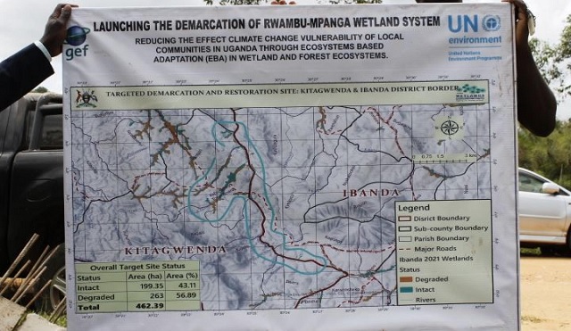
Kitagwenda, Uganda | THE INDEPENDENT | The Ministry of Water and Environment has started the demarcation of three major wetlands in Kitagwenda district. The wetlands are Kanunka, Ruhagura, and Kyarutanga all in Kabujogera town council.
The ministry’s intervention follows the rampant human activities like cultivation, brick-making, and planting of eucalyptus trees in these wetlands. The wetlands pour their water into River Rwambu which is a tributary of River Mpanga.
Lucy Lyango, the Acting Commissioner for Wetland Management, says that the demarcation of wetland boundaries was part of interventions by the government to restore the wetlands in the country. She explained that the demarcation of wetland boundaries will be done using pillars and Global Positioning System (GPS) locations.
Anthony Kalyegira, the Kitagwenda District Senior Environment Officer, said that the level of wetland degradation in the district stands at over 40 percent. He called for urgent interventions to restore the integrity of the wetland ecosystems.
The demarcation has left some residents protesting the move, saying that wetlands are a source of water and a source of income. Residents said the demarcation will now leave them stranded without earning income to sustain their families.
The demarcation exercise will be carried out in other districts which include Kamwenge, Ibanda, Bushenyi and Isingiro, Sironko, Kalumbuli, Kapchorwa, and Kween.
*****
URN